


All quoted text is from the Somerset Historic Enviroment Record. The main HER site is at
http://www.nsomerset.gov.uk/Environm...eology/HER.htm
Heritage Gateway
http://www.heritagegateway.org.uk/ga...outh-West.aspx
Info and History
“A World War 2 anti-invasion stop line, facing west, built between July and November 1940.
The stop line runs for approximately 50 miles from the mouth of River Brue to the mouth of the River Axe in Devon (with some infrastructure in Dorset). Some rear positions were prepared to the E of line. It connected to the ‘GHQ Line Green’ running East along River Brue.
The line followed the River Parrett to Bridgwater where it joined the Bridgwater to Taunton Canal. From Creech St Michael it followed the old Chard Canal until SW of Ilton where it joined the Great Western Railway. The line left the GWR to the north of Chard Junction from where it followed the Southern Railway and River Axe running south into Devon.
The planned infrastructure (most of which was built) included 233 pillboxes, 61 medium machine gun emplacements, 21 anti-tank gun emplacements, 83 road blocks, 22 railway blocks and 46 demolitions.
The anti-tank obstacle consisted of about 24 miles of waterways, 7 miles of improved water obstacles, 11 miles of anti-tank ditches and 8 miles of artificial obstacles (eg cubes).
From autumn 1940, twelve locations were prepared for all-round defence as ‘anti-tank islands’ of which 9 were in Somerset - Bridgwater, Durston, Creech St Michael, Wrantage and Crimson Hill, Ilton, Ilminster, Chard, Forton and Perry Street.”
http://webapp1.somerset.gov.uk/her/d....asp?prn=15410
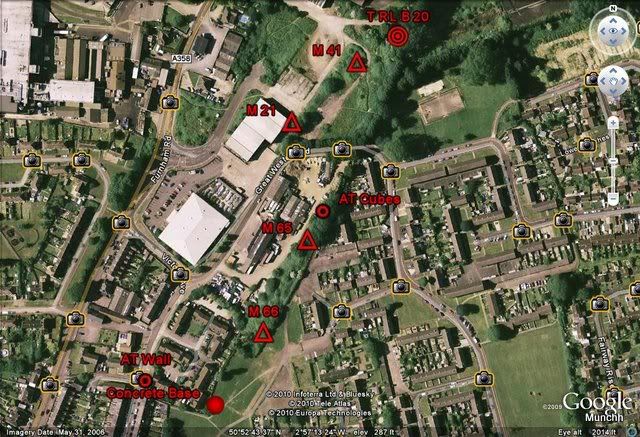
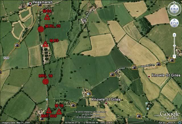
I’ve split this into 3 sections, Chard Joint railway station, Chard Reservoir north to Knowle St Giles and Knowle St Giles to Peasmarsh.
Chard Joint Railway Station
http://webapp1.somerset.gov.uk/her/d....asp?prn=55455
Chard Joint had defences forming the NW corner of the Chard Anti-Tank Island as well as being part of the Taunton Stopline proper. The labels given in my GE map shots are the original 1940 Stopline/ATI serial numbers for each site. I haven’t visited all of them yet so updates will follow.
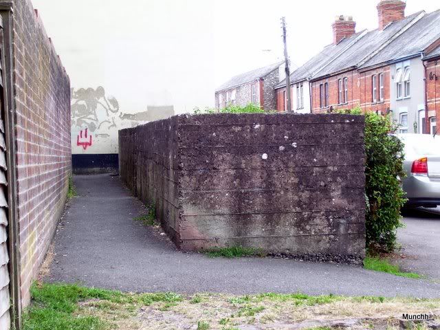
The Anti Tank wall at the southern end of the goods yard on the west side of the trackbed.
A concrete base or platform approx 20 feet x 15 feet is apparent although partially buried by landscaping. Of unknown origin but probably connected to Stopline or AT island as it's immediately adjacent to the old route of the trackbed.
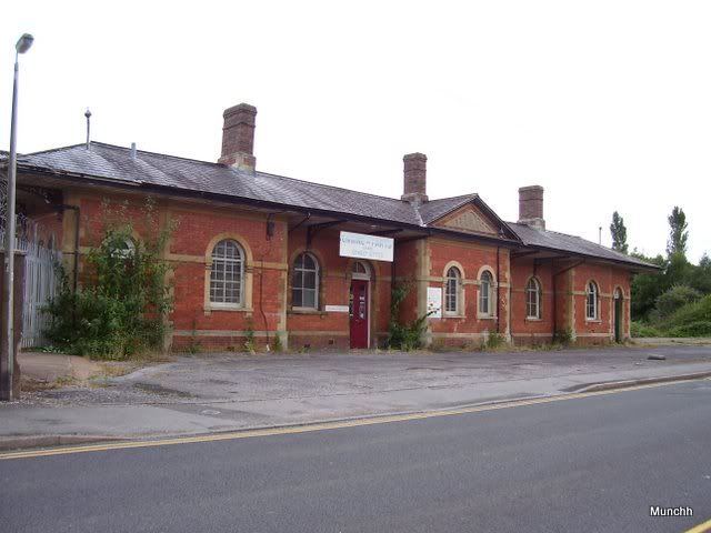
The station building
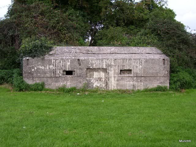
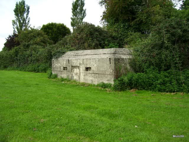
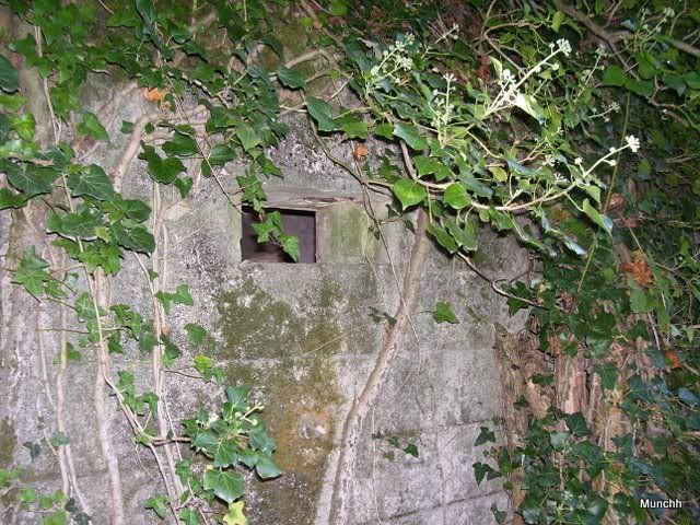
Pillbox M 66 – Type 24 - LMG emplacement
http://webapp1.somerset.gov.uk/her/d....asp?prn=55292
Pillbox M 65 (Type unknown) and AT cubes
http://webapp1.somerset.gov.uk/her/d....asp?prn=15943
The cubes are there but I couldn’t find the PB which is annoying as it’s described as a rectangular LMG emplacement on the original records. Will be taking another look.
From North of Chard Reservoir to Knowle St Giles (TSL)
Pillbox M 20 – Type 24 – LMG Emplacement
http://webapp1.somerset.gov.uk/her/d....asp?prn=55187
It’s buried in here
There was also a roadblock (M RD 39) at this location.
Rail Block M RL 17
http://webapp1.somerset.gov.uk/her/d....asp?prn=16098
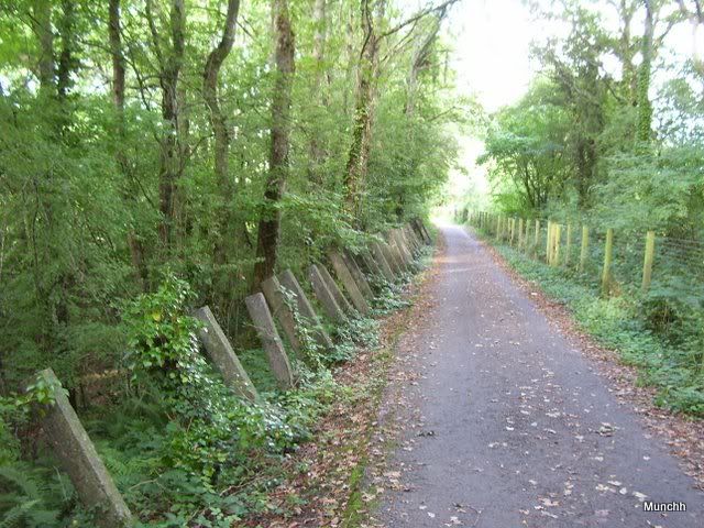
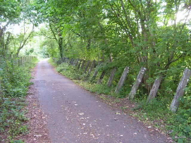
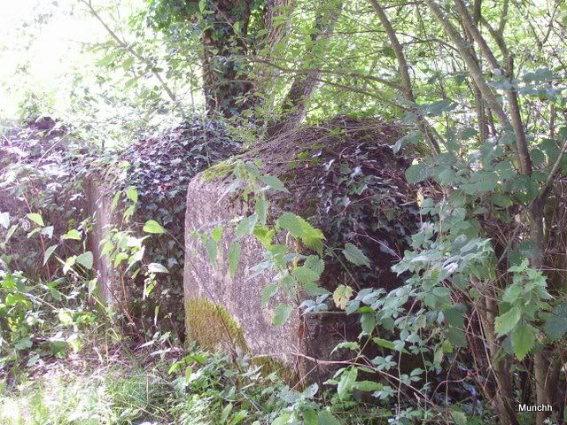
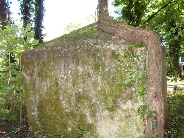
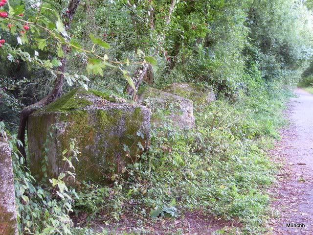
AT Posts and Cubes
http://webapp1.somerset.gov.uk/her/d....asp?prn=16099
These run every 3 feet on the west side of the trackbed from just after M RL 17 to just before MAT 609 at the bridge.
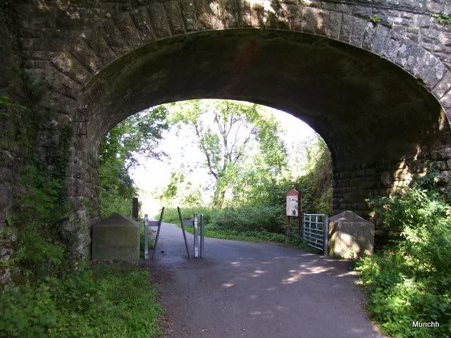
The bridge
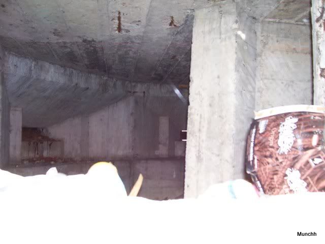
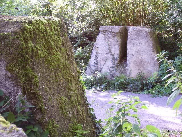
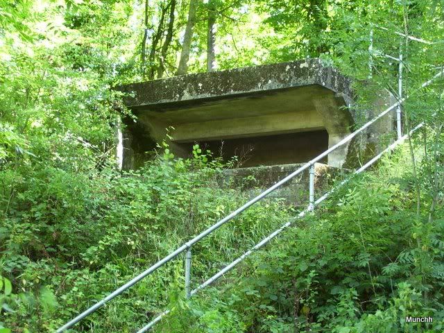
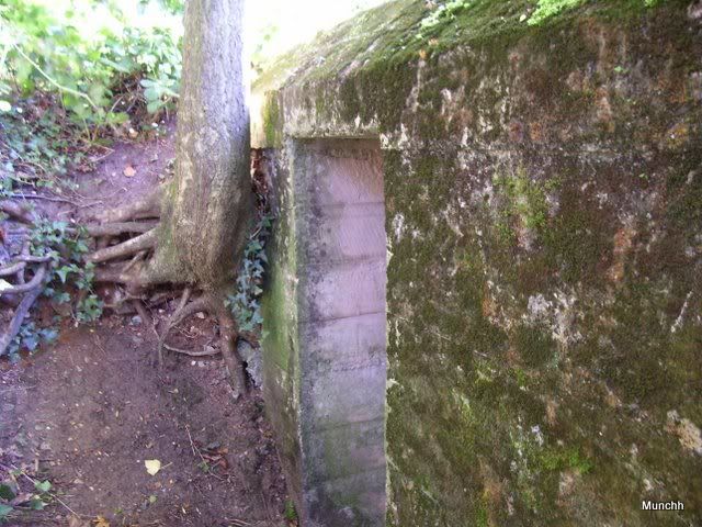
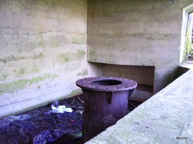
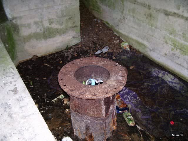
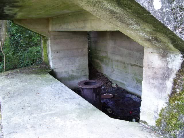
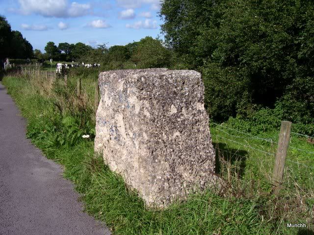
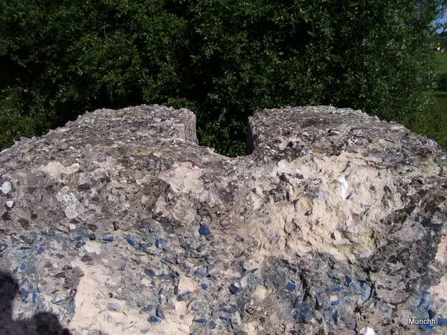
Pillbox MAT 609 – drg. no. LT 55 – Gun Emplacement
http://webapp1.somerset.gov.uk/her/d....asp?prn=55177
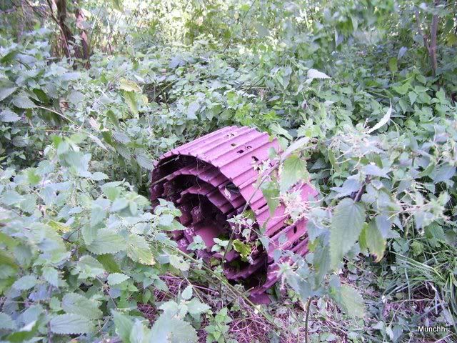
This was lying nearby
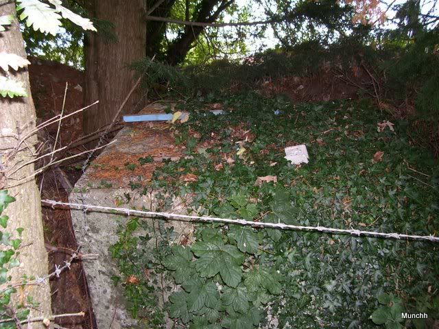
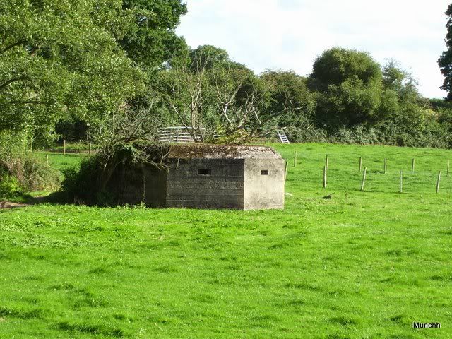
Pillbox M 19 – Type 24 – LMG Emplacement
http://webapp1.somerset.gov.uk/her/d....asp?prn=55190
Originally disguised as a chicken hut. Pretty good description for a pillbox.
Knowle St Giles to Peasmarsh
Railblock M RL 16
http://webapp1.somerset.gov.uk/her/d....asp?prn=15978
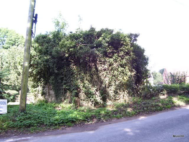
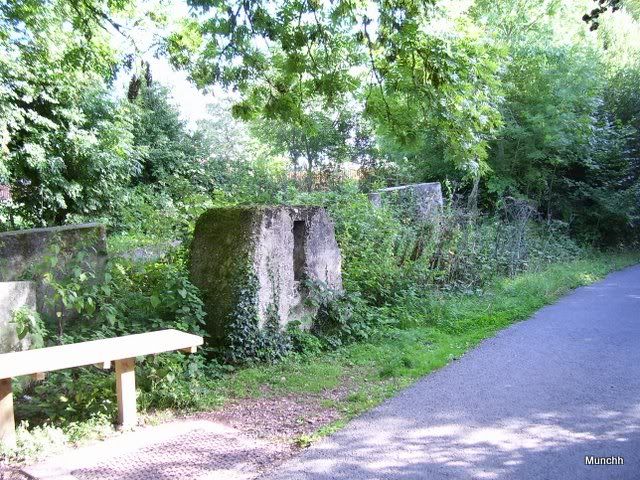
Pillbox M 63 – Type 24 – LMG Emplacement
http://webapp1.somerset.gov.uk/her/d....asp?prn=55188
Definitely there but totally overgrown and only accessible from inside the Sewage works compound. Will come back to it.
As you can see from the GE map shots, I haven’t got to everything on this section yet but I will. Hope you enjoyed what I was able to photograph. Thanks for looking.
Results 1 to 6 of 6
-
16-09-2010, 12:08 AM #1
 Houdini's love child
- Join Date
- Aug 2010
- Location
- Somerset
- Posts
- 57
- Thanks
- 3
- Thanked 17 Times in 13 Posts
 Taunton Stopline Chard Joint to Peasmarsh September 2010
Snort,fart, burble, dribble, belch
Taunton Stopline Chard Joint to Peasmarsh September 2010
Snort,fart, burble, dribble, belch
-
The Following User Says Thank You to Munchh For This Useful Post:
Midnight Rambler (16-09-2010)
-
16-09-2010, 10:03 AM #2
UF Silver Member
- Join Date
- May 2008
- Posts
- 1,180
- Thanks
- 82
- Thanked 117 Times in 85 Posts
Re: Taunton Stopline Chard Joint to Peasmarsh September 2010
nice research there fella, and a well put together report

-
16-09-2010, 10:14 AM #3
Super Moderator
- Join Date
- Apr 2008
- Posts
- 2,262
- Thanks
- 43
- Thanked 515 Times in 258 Posts
Re: Taunton Stopline Chard Joint to Peasmarsh September 2010
Yes yes, excellent stuff, I really like this.
I love projects like this and I'm working on a similar thread up here.
Again, a nice thread full of cool pics and good info.Under the radar, over the top
-
16-09-2010, 10:58 AM #4
French Letter
- Join Date
- Apr 2008
- Location
- T'uddersfield.
- Posts
- 1,064
- Thanks
- 35
- Thanked 156 Times in 149 Posts
Re: Taunton Stopline Chard Joint to Peasmarsh September 2010
nice report, i love stuff like this and the story of how a nazi invasion would have been slowed down considerably, enabling us to move troops in on them.
Saviour of the sporran
-
16-09-2010, 11:05 AM #5
Super Moderator
- Join Date
- Apr 2008
- Posts
- 2,262
- Thanks
- 43
- Thanked 515 Times in 258 Posts
Re: Taunton Stopline Chard Joint to Peasmarsh September 2010
I think slowing them down would be the least of our problems if they'd got this far Ernie LOL Originally Posted by ERNIE99_UK
 Under the radar, over the top
-
16-09-2010, 08:16 PM #6
Houdini's love child
- Join Date
- Aug 2010
- Location
- Somerset
- Posts
- 57
- Thanks
- 3
- Thanked 17 Times in 13 Posts
Re: Taunton Stopline Chard Joint to Peasmarsh September 2010
Thanks for the feedback guys, much appreciated. Are you working on a Stopline KingElvis?
There are a lot of reasons, other than just the Stoplines, why a German invasion would not have been succesful. I personally believe the assault would have failed and the defences would have been as effective as they needed to be.
If they had been able to just dump the entire German 'Blitzkrieg' machine in the middle of Britain they'd have pulverised us. The force they could actually have landed would not have been anywhere near as effective. Snort,fart, burble, dribble, belch


 Reply With Quote


Similar Threads
-
Archived: Boeing 747 8th september 2010
By wevsky in forum TransportReplies: 0Last Post: 08-09-2010, 08:10 PM -
Origin Crane, Manchester - September 2010. - ARCHIVE
By crippletron 3000 in forum Cranes And High BuildingsReplies: 2Last Post: 03-09-2010, 05:22 PM -
Archived: Taunton Stopline South Chard section July 2010
By Munchh in forum Military sitesReplies: 7Last Post: 13-08-2010, 11:36 PM
