

Visited with DJ OSKA who was able to arrange for the keyholder to open both the operations block and the generator house for viewing.
From the sign on the site erected by the Commons Committe with assitance from the radar museum at Neatishead..
RAF Barrow CommonFrom 1940 to 1944 this site was manned as a radar station to detect aircraft, especially low-flying, attacking the country. It was built in 1940 by JF Williamson, builders of Burnham Market. Initially the Coastal Defence station was manned by the army, with a Chain Home Extra Low radar set capable, with a “bedstead” aerial mounted on the roof, of detecting aircraft up to 35 miles out and with a field of vision from north-west to north-east.
A Second World War Radar Station
It was one of a number of Chain Home Low or Extra Low radar stations, linking to the east probably with a station on Bard Hill behind Salthouse and another at West Beckham behind Sheringham, and to the west at Stenigot and Skendleby in Lincolnshire. These were positioned with as clear and unimpeded a view of the sea as possible. Certainly the site of Barrow Common’s radar station was well suited. Less suitable was the bedstead aerial which had to be turned by hand, often difficult in high winds. Scanning was therefore frequently exhausting for the operators.
In early 1942 the station was taken over by the RAF as a Joint Air and Surface Watching Station, although in a standby surface watching role, as the main danger was still thought to be low-flying aircraft. The bedstead aerial was replaced by a lattice tower about 100 yards (90m) to the south-east, probably 200 ft (81m) high. The four concrete blocks on which the corners if the tower rested can still be seen. This increased the range significantly.
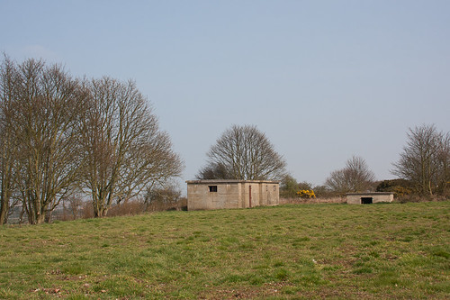
RAF Barrow Common was likely to have been manned not only by RAF personnel but also four naval ratings responsible for plotting ships, and four army observers – over 80 personnel in total. There would have been four watches of six hours each. Personnel were billeted at Valley farm just to the east of the common. Of the two buildings the larger housed the radar equipment and screens, and probably a restroom for the operators. The small building contained the diesel power plant. The station was closed in 1944 after the invasion of the continent by the allied armies.
This may be taken as the official history, although there are still some details to be confirmed.
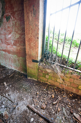
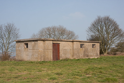
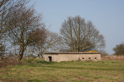
The exterior..
On the left is the operations block, the lower block is the generator house.
The operations block, the door used to access the building is on the far end. The door visible in the shot is to/from the third and furthest room.
The generator house.
Results 1 to 10 of 10
-
29-03-2011, 11:24 PM #1
 Сталкер
- Join Date
- Feb 2011
- Location
- West Norfolk
- Posts
- 246
- Thanks
- 24
- Thanked 70 Times in 56 Posts
 RAF Barrow Common, Chain Home Low radar station (March 2011)
Last edited by SaltGeorge; 29-03-2011 at 11:45 PM. Reason: typo
-
29-03-2011, 11:28 PM #2
The Busman
- Join Date
- Aug 2010
- Location
- North Norfolk
- Posts
- 74
- Thanks
- 5
- Thanked 12 Times in 9 Posts
Re: RAF Barrow Common, Chain Home Low radar station (March 2011)
Thanks for tagging along this afternoon, SG.
The video should be good when it's finished...
You sticking any internal shots up? :-D
-
29-03-2011, 11:31 PM #3
Сталкер
- Join Date
- Feb 2011
- Location
- West Norfolk
- Posts
- 246
- Thanks
- 24
- Thanked 70 Times in 56 Posts
Re: RAF Barrow Common, Chain Home Low radar station (March 2011)
Entering the operations block.
The operations block is sub-divided into three rooms.
The first room.
Entry was by the door on the right. The Commons Committee uses this room to store some timber and fence posts. Note the floor joists set into the floor. There is a pale/white "tide mark" around the wall that appears to indicate the original wooden floor level. This is the smallest of the three rooms.
Looking from the door end towards the position the first photograph is taken from. The door on the right leads through to the second room and there are indications that the doorway was fitted with a sliding door.
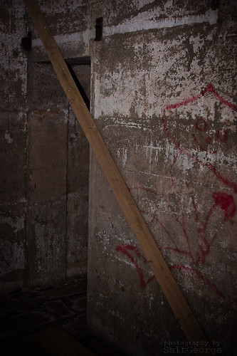
The door from the first room to the second room showing the remains of the sliding door rail. On the left of the door you can still make out the shadow of the light switch. All cabling and switches have been removed, but the traces remain on the walls.
-
29-03-2011, 11:44 PM #4
Сталкер
- Join Date
- Feb 2011
- Location
- West Norfolk
- Posts
- 246
- Thanks
- 24
- Thanked 70 Times in 56 Posts
Re: RAF Barrow Common, Chain Home Low radar station (March 2011)
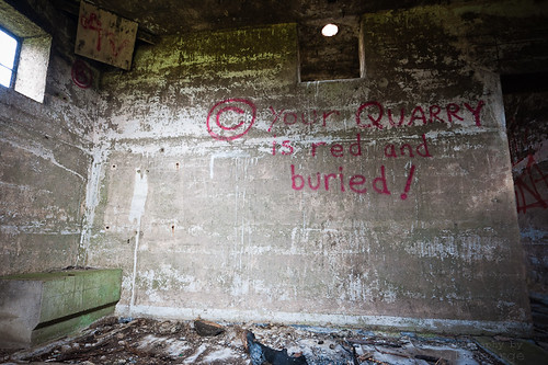
The second room is the largest of the three rooms.
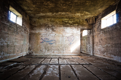
On the right of this shot is the doorway through from the first room. The remains of the floor joists are present throughout the operations block.
The two lines at right-angles to the floor joists appear to be channels for cabling. There are three channels in total set at unequal distances apart. In the top corner is a wooden panel set across the corner. It is believed that every corner was fitted with these. Behind the panels are a pair of slots leading to staggered air vents on the exterior (staggered in that there is no direct light-path from the outside to the inside via the ventillation vents. It is my guess that the wooden panels either served as diffusers to prevent draughts, or they provided a secondary light baffle to prevent light entering or escaping via the vents.
Detail of a corner baffle.
Detail of the vent openings behind the corner baffles.
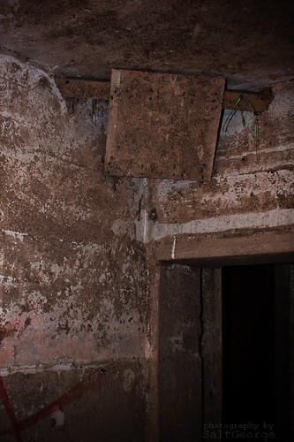
Still in the second room, but now looking the other way with the door to the third room on the left. Shadows on the wall again indicate a sliding door. The square cut-out in the wall straight ahead provides another connection to the third room. There are two approx. 4" glazed pipes penetrating the roof. The closest is directly above the dividing wall, the furthest is over the third room.
Detail of the aquare cut-out. The lower edge on both sides is rounded, these are the only rounded edges in the entire building that we could see. There are remains of a structure suspended from the ceiling and leading through the cut-out.
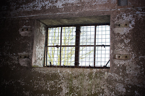
Window detail showing the remains of the fixtures for the shutters.Last edited by SaltGeorge; 29-03-2011 at 11:54 PM. Reason: Added photo (detail of vents)
-
29-03-2011, 11:53 PM #5
Сталкер
- Join Date
- Feb 2011
- Location
- West Norfolk
- Posts
- 246
- Thanks
- 24
- Thanked 70 Times in 56 Posts
Re: RAF Barrow Common, Chain Home Low radar station (March 2011)
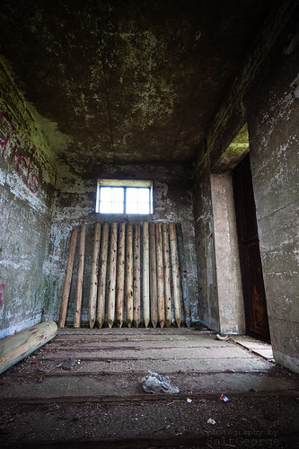
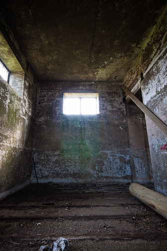
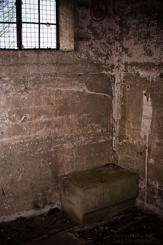
The third room, entered from the doorway on the left of the shot.
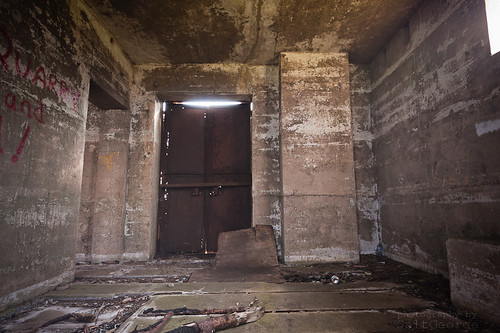
The door straight ahead is the door visible in the external shots.
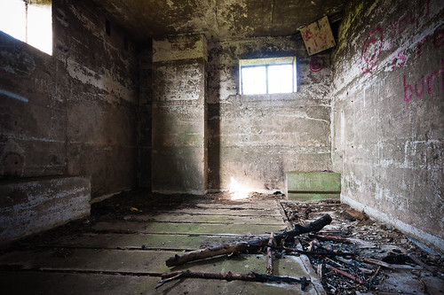
And looking the other way. This room has three interesting features, the large rectangular indentation in the floor visible on the right, the long concrete plinth on the left, and the smaller concrete plinth with the rebate visible straight ahead.
The larger concrete plinth. Of unknown purpose this is beneath the window on the end of the building. The composition of the concrete appears contemporary with the concrete used to construct the building.
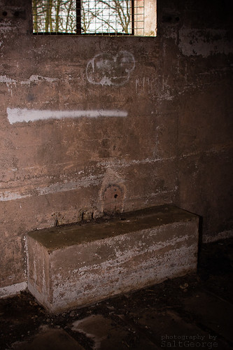
The smaller plinth is of a much smoother concrete and appears to be an addition. The chamfered rebate would appear to accomodate the level of the wooden floor. There are remains of two or three metal mounting bolts/studs.
The lower edge of the square wall penetration is also rounded on this side of the wall.Last edited by SaltGeorge; 30-03-2011 at 12:33 AM. Reason: typo
-
30-03-2011, 12:06 AM #6
Сталкер
- Join Date
- Feb 2011
- Location
- West Norfolk
- Posts
- 246
- Thanks
- 24
- Thanked 70 Times in 56 Posts
Re: RAF Barrow Common, Chain Home Low radar station (March 2011)
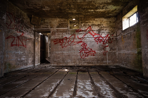
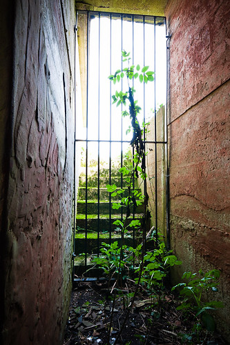
The generator house is a large room with a main entrances with stairs down from ground level, a cross passage and an escape entrance on the other side. There is also a very large entrance in the cross passage wall that is currently used to gain access to the building. It is possible to see most of the interior through the gate over this entrance.
Looking up the main entrance stairs.
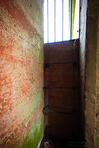
This is the exit from the other side of the cross passage. Metal steps have been set into the wall.
As I mentioned, the wall of the cross passage is incomplete. There is a neat opening with the remains of this brickwork visible from inside the building. I believe that this opening was used to place the generator into the building and then the opening bricked up afterwards with soil placed against the outside. The wall was then removed to remove the generator when the site was closed, resulting in the opening visible today.

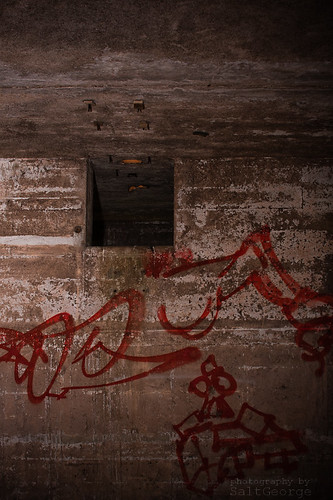
There is a single, dished generator bed. Beneath the accumulated debris there is a solid concrete floor. Around the wall are several inverted u-bend air vents for ventillation. The small pipe exitting the back of the room and visible behind the generator bed may have been the exhaust. There is no evidence of a cable route exitting the building.
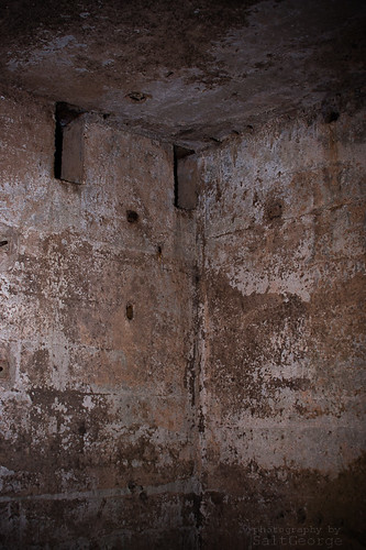
Several meters from the buildings are the remains of the tower. There are four concrete blocks set into the ground and visible on aerial photographs.
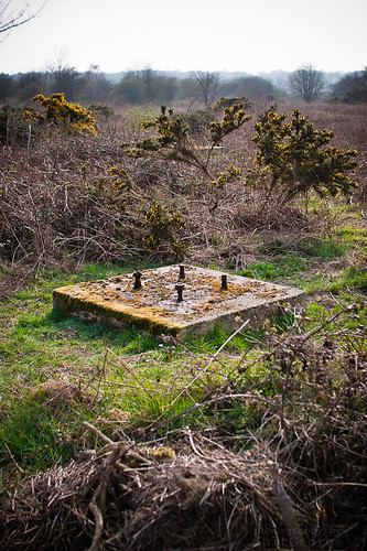
Two of the concrete tower bases are visible in this shot. The other two are to the left.
-
30-03-2011, 12:25 AM #7
The Busman
- Join Date
- Aug 2010
- Location
- North Norfolk
- Posts
- 74
- Thanks
- 5
- Thanked 12 Times in 9 Posts
Re: RAF Barrow Common, Chain Home Low radar station (March 2011)
Well done chap.
I like your level of detail- you can read these old buildings well.
Thanks again for tagging along :-)
-
30-03-2011, 07:13 AM #8
Super Moderator
- Join Date
- Apr 2008
- Posts
- 2,262
- Thanks
- 43
- Thanked 515 Times in 258 Posts
Re: RAF Barrow Common, Chain Home Low radar station (March 2011)
Yep, that's a good report there of an interesting place, nice of them to let you poke around.
It's pretty well preserved too for being nearly 70yrs old.
Ace.Under the radar, over the top
-
30-03-2011, 01:04 PM #9
urbex cripple
- Join Date
- Feb 2011
- Location
- lacaster/sheffield
- Posts
- 226
- Thanks
- 106
- Thanked 58 Times in 54 Posts
Re: RAF Barrow Common, Chain Home Low radar station (March 2011)
You never seem to disappont salt nice work from you and dj oska
Last edited by blueink; 30-03-2011 at 03:08 PM. Reason: Spelling again and again
-
02-04-2011, 06:21 PM #10
The Busman
- Join Date
- Aug 2010
- Location
- North Norfolk
- Posts
- 74
- Thanks
- 5
- Thanked 12 Times in 9 Posts
Re: RAF Barrow Common, Chain Home Low radar station (March 2011)
View the complete Norfolk Uncovered episode, featuring footage from both visits by myself, accompanied by Shadow_ops and SaltGeorge!
Full episode:


Similar Threads
-
Pakefield Radar CHL Station. March 2011. Pakefield Roc.
By Black Shuck in forum Military sitesReplies: 5Last Post: 29-03-2011, 01:01 PM -
HAPPISBURGH CHAIN RADAR. NORFOLK. 01/11.
By simonix in forum Military sitesReplies: 7Last Post: 03-02-2011, 09:27 PM -
Mangersta Chain Home Radar station
By PieceOfPaper in forum Older Reports ArchiveReplies: 10Last Post: 03-08-2009, 07:08 PM -
RAF Drytree Chain Home Low Station, Goonhilly, Cornwall May 2009
By doozer in forum Older Reports ArchiveReplies: 6Last Post: 24-06-2009, 08:59 PM -
Salthouse Chain Link Radar
By simonix in forum Older Reports ArchiveReplies: 0Last Post: 31-01-2009, 04:35 PM
